Bull Lake Cabin in Troy, Montana

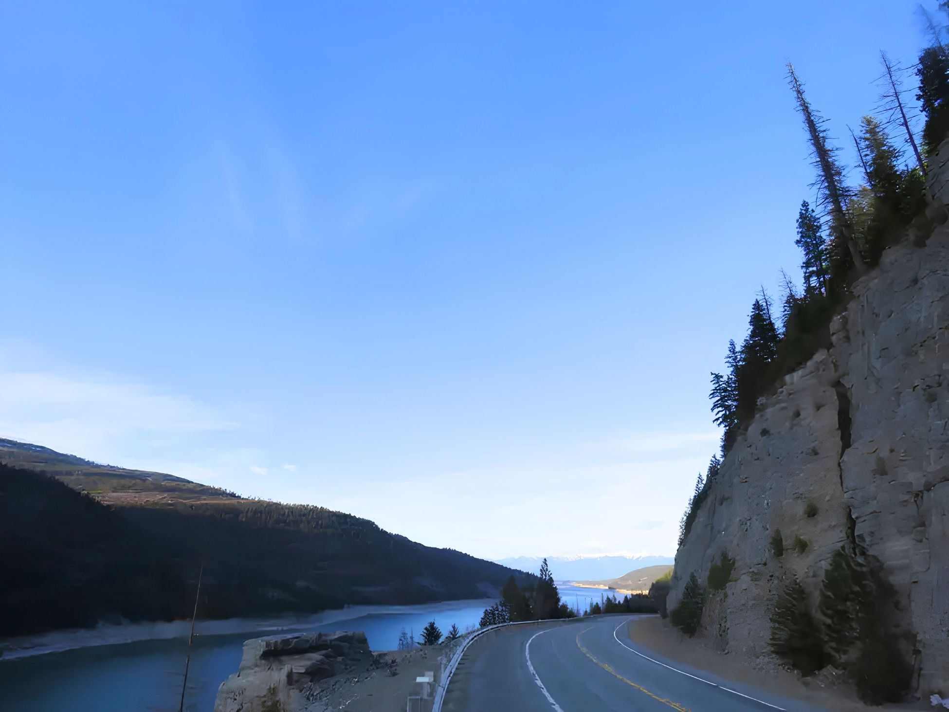
The Lake Koocanusa Scenic Byway runs sixty-seven paved miles along Highway 37 between Libby and Eureka, and it is the easiest big-scenery day you can have from a Bull Lake basecamp. You could drive the whole thing in about two hours if you never stopped. Almost nobody manages that.
The lake is a reservoir — ninety miles of it, held behind Libby Dam and reaching north across the border into British Columbia — and it fills a narrow trench between the Purcell and Salish mountains. The word people keep reaching for is fjord. Once you see the water pinched between rock walls a few hundred feet below the road, you understand why.
This is a guide to driving it from the cabin: the route, the stops worth braking for, what the reservoir’s water level does to the view, and the road work you should check on before you set out.
The short version
- Route: Montana Highway 37, Libby to Eureka — 67 miles, paved, open year-round.
- Optional loop: Forest Development Road 228 returns along the west shore. Paved and two-lane, but closed in winter.
- Time: two hours of pure driving end to end. From Bull Lake, the dam is about an hour away, so a half day gets you there and back with time to linger. The Koocanusa Bridge and Eureka make it a full day.
- Cost: free. The Libby Dam Visitor Center and its tours are free as well.
- Services: fuel, groceries, and coffee in Libby. Then essentially nothing until Rexford and Eureka at the north end.
- Cell service: none along most of the lake. Download your maps before you leave Libby.
- Best for: an unhurried half-day drive, wildlife watching, picnics with a long view, and anyone who likes water and mountains in the same frame.
Getting there from Bull Lake
Head north on Montana 56. The highway meets US 2 east of Troy, so you will not pass through town on the way out — if you want coffee first, Troy is a short detour west. From the junction, turn east on US 2 and follow the Kootenai River into Libby. Highway 37 leaves US 2 in downtown Libby and climbs northeast along the river.
Shangrilog to Libby is 37 miles and about 43 minutes in good conditions. Libby Dam is another 17 miles and roughly 20 minutes northeast on Highway 37, which puts the visitor center a little over an hour from the cabin door. Allow more in winter — Highway 37 and US 2 are both plowed and kept open, but the Kootenai canyon holds shade and ice well into the morning.
One thing worth knowing before you set the alarm: the drive to Libby runs directly past Kootenai Falls. It is right there on US 2, roughly halfway. If you have not seen the falls yet, you can either fold a short stop into the morning or save it for its own day — but it is not a detour, it is on the way.
Fill the tank in Libby and buy lunch there too. Once you are on Highway 37 there is no gas, no store, and no coffee for a long stretch. That emptiness is a good part of why the drive is worth doing — but it does reward a few minutes of planning at the grocery store.
Before you go — check current conditions
- Bridge work on Highway 37. The Montana Department of Transportation and its contractor are rehabilitating eleven bridges along MT 37 between Libby and Eureka. Work resumed in spring 2026 and is expected to wrap up in the fall. Expect ten- to fifteen-minute delays, reduced speeds, single-lane traffic, and a ten-foot width restriction through the work zones.
- Check 511 first. Montana’s traveler information service posts live road conditions, closures, and width restrictions at 511mt.net.
- The road across the top of the dam is closed. If you approach the dam from the north, you take a scenic detour below it and cross the David Thompson Bridge to reach the other side.
- Visitor center dates change. The Libby Dam Visitor Center has been operating a summer season with daily tours, and on-site construction has affected tour availability in recent years. Call ahead at (406) 293-5577 before you build the day around a tour.
- No cell coverage. Download offline maps and tell someone your plan.
Libby Dam, and the first big view
Libby Dam is the reason the lake exists. Finished in the early 1970s under the Columbia River Treaty, it is a concrete wall more than four hundred feet tall across the Kootenai River, and the reservoir that formed behind it swallowed a whole string of small valley towns.
The visitor center sits at the top of the dam on the west side, up Forest Development Road 228. Inside are exhibits on how the dam was built, how five turbines turn falling water into electricity, and how the lake got its odd name. When the dam was under construction, the Army Corps ran a contest to name the reservoir. A woman from Eureka won it by stitching together the first three letters of Kootenai, Canada, and USA. The Corps posts current visitor center and recreation information for Libby Dam if you want to check before you go.
Next to the visitor center, the Souse Gulch day-use area has picnic shelters, playgrounds, a boat ramp, and an eighteen-hole disc golf course laid out across the hillside. It is an unexpectedly good lunch stop, with the lake below and the Cabinet and Purcell country stacked up in every direction.
Below the dam is a designated watchable-wildlife area. Bald eagles and osprey work the tailwater, and the water there has a reputation among anglers — the Montana state record rainbow trout, a thirty-three pound fish, came out of that stretch in 1997.
Northbound: the stops worth braking for
Highway 37 climbs past the dam’s eastern abutment and then hugs the east shore for the rest of its run, winding along the old canyon walls. The pullouts are informal and frequent. These are the ones with something at the end of them.
Cripple Horse and McGillivray
Both sit within about seven or eight miles of the dam, one on each shore. Cripple Horse has camping, a marina, boat launching, and picnic tables. McGillivray, on the west side, is the friendlier stop for families — a sandy swimming beach, group picnic shelters, flush toilets, and a short trail that climbs through a meadow and drops back to the water.
The Koocanusa Bridge
This is the photograph everyone comes home with. Montana’s longest and tallest bridge crosses the reservoir about seven miles south of Rexford: a multi-truss span roughly 2,437 feet long, standing around 270 feet above the water when the lake is full. There is a parking and viewing area on the highway side.
Worth setting expectations on: the bridge sits well up the byway, roughly thirty miles north of the dam and closer to Rexford than to Libby. It is not a quick add-on to a dam visit. Build it into a full day rather than trying to squeeze it into an afternoon.
Walk out a little way if you are comfortable with height. The bridge carries you over to the west shore, a small farming community, and the back road into the Yaak — which is a whole other day’s drive and worth its own trip.
Rocky Gorge, Peck Gulch, and Barron Creek
Three Forest Service recreation sites strung along the east shore, all with boat ramps and lake access. Rocky Gorge is the largest, with around 120 campsites and an easy day-use area. Peck Gulch is smaller and quieter, with restrooms and a wide flat bench by the water — the access road down to it is steep, so think twice if you are towing. Barron Creek is the most basic of the three: a ramp and dispersed camping. The Forest Service lists current details for each Koocanusa area site, including seasonal opening dates.
Rexford and Eureka
Rexford is a town that moved. The original site, established along the railway in 1901, is under the lake; the federal government relocated the town uphill during dam construction, which is why the street plan and many of the buildings read as mid-century. There is a campground on the bench above the water and a marina nearby — check seasonal hours before you count on either.
Eureka, at the north end where Highway 37 meets US 93, is the natural turnaround. It has restaurants, fuel, and a walkable main street, and it makes the difference between a half-day drive and a satisfying full one.
The west-shore loop
If you would rather not retrace the same sixty-seven miles, Forest Development Road 228 runs down the west side of the lake and turns the drive into a loop. It is paved and two-lane, slower and more forested than the highway, with the views arriving in glimpses instead of panoramas. It closes for the winter, so it is a summer and early-fall option only.
The same corridor also carries a hundred-mile circular bicycle route that starts at Libby Dam, if anyone in your group is the sort who brings a road bike on vacation.
Watching for wildlife
The rock outcrops and ledges above the highway are bighorn sheep habitat, and the Forest Service notes that sheep are seen along the byway frequently. Frequently is not the same as reliably — like everything wild, they show up on their own schedule. The forests along the corridor also hold whitetail and mule deer, elk, moose, bear, coyotes, eagles, and osprey.
Early morning and the last hour of light are your best odds. Keep binoculars on the dash, pull fully off the pavement before you look, and give animals room. If wildlife is the point of your trip, our notes on wildlife watching around Bull Lake cover what to expect closer to the cabin.
When to drive it, and why the water level matters
This is the part most guides leave out. Koocanusa is a working reservoir, not a natural lake, and its surface moves through a range of well over a hundred feet across the year. The typical pattern: the lake fills through early summer and reaches full pool around July, drawdown begins in September, and the water keeps dropping to a minimum by April.
What that means for the drive:
- July and August are the postcard months. The lake is at or near full pool, the water comes up close to the road in the narrow sections, the boat ramps are usable, and the swimming beaches are actually beaches. This is also the busiest stretch and the most likely to bring wildfire smoke later in the season.
- September and October may be the best compromise. The drawdown has only just started, larch turn gold on the slopes above the water, the light gets long and low, and the traffic thins out considerably.
- November through March is stark and genuinely beautiful in its own way. Highway 37 is plowed and kept open year-round, but the west-shore loop is closed, the lake is well down, and wide pale bands of exposed shoreline and old stumps stand above the water. Drive it for the quiet, not for the picnic. Watch for ice and for deer at dusk.
- April and May bring the lowest water of the year, when the reservoir looks least like a lake and most like a canyon with a river in it. The side gulches run hard with snowmelt, and you will have the pullouts almost entirely to yourself.
If you are still deciding when to come to this corner of the state, our guide to the best time to visit Northwest Montana walks through the seasons in more detail.
Fishing and boating, briefly
Koocanusa holds a well-known landlocked salmon fishery — kokanee — along with rainbow, westslope cutthroat, whitefish, and burbot, and bull trout are present and protected. If you plan to fish, check the current Montana Fish, Wildlife & Parks regulations for the reservoir before you go, since rules differ by species and by season.
A practical note for boaters: ramp usability tracks the water level, so a ramp that is fine in July can be well above the waterline by late fall. If you would rather keep things simple, the cabin’s own dock and the quiet water of Bull Lake are a short walk from the door — fishing on Bull Lake needs no trailer at all, and neither does paddling from the dock.
Making a day of it from Shangrilog
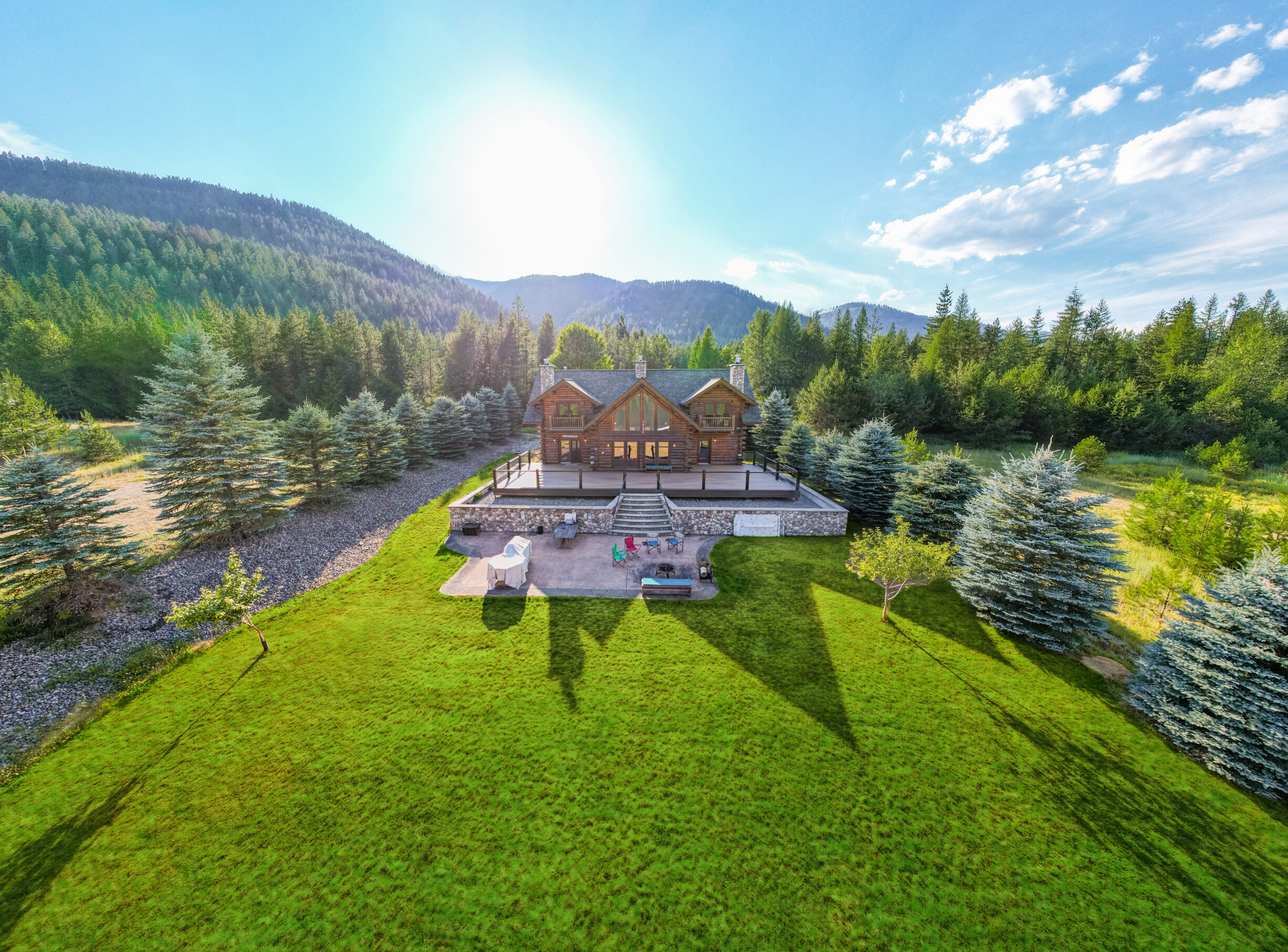
The byway pairs well with a slow morning at the cabin, and it splits cleanly into two versions.
The half day turns around at the dam. Coffee on the deck, leave mid-morning, groceries and fuel in Libby, then twenty minutes up Highway 37 to lunch at Souse Gulch with the lake below you. Wander the visitor center, walk a little of the shoreline, and come home in time to swim off the dock before dinner. That is about two hours of driving spread across five or six hours of day, which is the right ratio for a vacation.
The full day keeps going north — past Rocky Gorge and Peck Gulch, out to the Koocanusa Bridge for the view, and on to Eureka for a late lunch. Come back down the west shore on Road 228 if it is open and you have the daylight. Leave early, pack a cooler, and expect to be out most of the day. It is a lot of driving, but it is the good kind, and you will have seen the whole lake.
Either version leaves room for the rest of the area on other days. Ross Creek Cedars is a short drive from the cabin in the other direction and is the better choice for a shorter, greener outing, and there is more in our area guide and our roundup of things to do near Bull Lake if you are still building the itinerary. What ties it together is having a real kitchen and a lake at the end of the day rather than a motel parking lot — which is most of what the cabin itself is for.