Bull Lake Cabin in Troy, Montana

The Cabinet Mountains Wilderness starts a short drive south of the cabin, and most of its finest trails are day hikes: three to eight miles round trip, one alpine lake or one old lookout at the end, back in time for dinner on the deck. What follows is how to choose one, when to go, and what the roads in are actually like.
A 94,000-acre wilderness with a highway along its edge
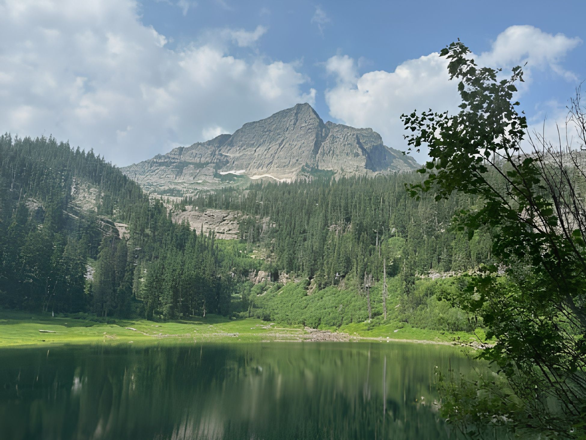
The Cabinet Mountains Wilderness covers 94,272 acres across Lincoln and Sanders counties, inside the Kootenai National Forest. It was set aside as a Primitive Area in 1935 and became one of the original units of the National Wilderness Preservation System when the Wilderness Act was signed in 1964. Snowshoe Peak, at 8,738 feet, is its high point, and it still holds the last glacier in the range.
What makes it unusually reachable is geography. Montana Highway 56 runs the length of the wilderness along its western edge, connecting US Highway 2 in the north with Montana 200 in the south. Bull Lake sits on that highway, which is what makes a cabin on this stretch of Highway 56 a practical base rather than just a scenic one. From the cabin you turn south, drive past the Bull River, turn up a gravel Forest Service road, and you are at a trailhead. No shuttle, no permit, no gate.
The trails are honest about what they are. The interior of the range is too steep and broken for trail, so nearly every route runs in and out along a single drainage to a single destination: an alpine lake in a rock bowl, or a ridge with an old lookout on it. That structure is a gift for day hikers. You know exactly where you are going and roughly how long it will take.
Three things that decide your day
Snow leaves the basins late
Most of these trails end between 4,500 and 6,000 feet in north-facing bowls, and snow sits in them long after the lake down at the cabin is warm enough to swim. Mid-July through early October is the dependable window. June hikes often end at a snowfield short of the lake. By late September the bugs are gone and the larch on the lower slopes begin to turn, which makes for the quietest, best-smelling hiking of the year if you do not mind a cold start.
The road is usually the hard part
Every trailhead here sits at the end of a gravel Forest Service road, and those roads take a beating. The Kootenai National Forest has been working through washouts from a December 2025 atmospheric river that damaged culverts, bridges, and road edges across the forest, including Ross Creek Cedars Road #398. Some of that repair work may be finished by the time you visit and some may not.
So check before you drive. The Forest publishes a running alerts page and a trail-clearing report, and the district offices answer the phone: the Cabinet Ranger District at (406) 827-3533 for the Bull River side, the Libby Ranger District at (406) 293-7773 for the Libby side. Five minutes on the phone can save you an hour of driving to a closed gate. Ask us, too. We hear about road conditions from guests all summer.
This is grizzly country
The Cabinets hold a small, closely watched grizzly population as part of the Cabinet-Yaak recovery area, along with black bears throughout. Carry bear spray somewhere you can actually reach it, not buried in a pack. Make noise on brushy stretches, especially where the trail runs through head-high huckleberry. A mandatory food storage order applies across the Kootenai National Forest, which means food, garbage, and anything scented has to be stored properly, including in your vehicle at the trailhead.
None of that should put you off. It is the reason the country up there still feels the way it does.
Six day hikes, roughly closest first
Mileages below are one way, as listed in the Cabinet Ranger District trail guide. The elevation figures are the Forest Service’s listed change for the full trail, so treat them as “expect to climb,” not as a precise gain. The order runs closest to furthest from the cabin.
Dry Creek Trail #1020 — the easy one
3.7 miles one way, about 500 feet. Starts right off Highway 56 and follows the Bull River along the boundary between national forest and private land. Nearly flat, shaded, cool in August. It does not cross into the designated wilderness itself, it is the corridor that feeds trails that do, but for a first afternoon, a group with mixed legs, or a walk with kids who want a river to throw rocks into, it is the best low-effort option on this side of the range. Turn around whenever you like.
Berray Mountain West Trail #1028 — the most view for the least work
1.6 miles one way, about 900 feet. This short spur climbs from Road #2272 and joins Berray Mountain Trail #967 about half a mile below the historic Berray Mountain lookout tower. From up there the Bull River valley opens below you and the wall of the Cabinets stands to the east. If you want the whole climb instead, Berray Mountain Trail #967 runs 5.3 miles from Road #407 with roughly 3,400 feet of gain, which makes for a long day and a quiet one.
St. Paul Lake Trail #646 — the classic
3.9 miles one way, about 2,800 feet. The trailhead sits about six miles up the East Fork Bull River Road (#407) off Highway 56, roughly half an hour from the cabin, which makes it the closest true wilderness trailhead to Bull Lake. It was rebuilt in 2024, so the first stretch may not match older maps or older trip reports. The trail follows the East Fork through moss, devil’s club, and cedar big enough to change the light. The Forest Service describes the feel as a rain forest, and in a wet June that is exactly what it is. Boardwalk puncheons carry you over the seeps. Elephant Peak at 7,938 feet and St. Paul Peak at 7,714 feet stand over the last mile.
The lake sits at about 4,780 feet in a rock basin and holds cutthroat trout. One honest warning: the Isabella Creek crossing is difficult and can be dangerous for much of the season, and the East Fork is crossed twice, with one bridge that is fine on foot but not for stock. In high water, save this one for later in the summer.
Devils Club Trail #966 — for solitude
4.2 miles one way, about 3,000 feet. Also off Road #407. Steeper, brushier, and far less traveled than St. Paul Lake. You will likely see no one all day. Bring long sleeves. The trail is named for the plant, and the plant is not kidding.
Rock Lake Trail #935 — the one with a story
4.1 miles one way, about 1,600 feet. Reached from Road #150A on the Noxon side, fifty minutes south down Highway 56. The reward is a trail that passes the remains of the Heidelberg Mine and a waterfall on its way to a lake ringed in rock. It is also the gentlest climb per mile of any lake hike here, which makes the drive easier to justify.
Leigh Lake Trail #132 — the biggest payoff per mile
Roughly 1.5 to 2 miles one way, steep throughout. This one sits on the Libby side of the range and takes real driving: an hour and twenty minutes, north on Highway 56 and east on US 2 past Libby, then Bear Creek Road to Cherry Creek Road #867 and Leigh Creek Road #4786. It is the longest drive on this list and the one to leave the cabin early for. It is also the most popular hike in the wilderness, and deservedly so. Under two miles takes you past Leigh Creek Falls and into a basin directly beneath the cliffs of Snowshoe Peak. Mountain goats are often on the slopes above the lake, though as with everything up here that is a possibility rather than a promise. No camping is allowed at Leigh Lake, so it is a day hike by design.
Drive times from the cabin
All of these are measured from the cabin door and assume dry roads. For a sense of scale, Ross Creek Cedars is 13 minutes away, so the nearest wilderness trailheads sit only about fifteen minutes beyond a stop most guests already make. Add time in the shoulder seasons and after heavy rain.