Bull Lake Cabin in Troy, Montana
Bull Lake sits in the far northwest corner of Montana, in Lincoln County, strung along a two-lane highway most people here still call Bull Lake Road. On a map it is Montana Highway 56. It runs roughly thirty-five miles between US Highway 2, a few miles east of Troy, and Montana Highway 200 down near Noxon, and every mile of it lies inside Kootenai National Forest.
That is the honest short answer: whichever direction you come from, you will end up on MT-56. The rest of this guide is about which end to enter from, which airport actually makes sense, and what the drive asks of you once the towns thin out.

Three commercial airports serve this corner of the state, and the right one usually depends more on how your flights line up than on raw mileage. All three sit between two and a half and three hours from the cabin – worth building into your first day rather than discovering at the rental counter.
The closest of the three – 134 miles and about 2 hours 24 minutes from the cabin. From FCA you head west on US-2, following the Kootenai River through Libby, then continue west toward Troy. Several airlines serve Kalispell, some only seasonally, so check current schedules at iflyglacier.com.
Usually the widest choice of flights and often the easiest to book. There are two sensible ways in. The southern route – through Sandpoint and east along MT-200 to the bottom of Highway 56 – is the quicker of the two at 142 miles and about 2 hours 38 minutes. Running US-2 the whole way, through Bonners Ferry and Troy, is 150 miles and about 2 hours 55 minutes. Schedules at spokaneairports.net.
One thing to set your watch by: Spokane and the Idaho panhandle run on Pacific time, and the cabin is on Mountain time. Coming in from the west you lose an hour on the clock, which catches people out on a late arrival.
The longest drive of the three at 156 miles and about 2 hours 51 minutes, and worth choosing mainly when the flights work better than the alternatives. From Missoula you come north and west on MT-200, up through Plains, Thompson Falls and Trout Creek to Bull River Junction. Schedules at flymissoula.com.
This is how most guests arrive. US-2 traces the Kootenai River through timbered mountains, and it is a genuinely good drive rather than something to endure.
Coming from Kalispell, you follow US-2 west through Libby and stay on it as the river valley narrows. The turn for MT-56 comes up about three miles before you would reach Troy – a left turn, heading south. It is signed, but it arrives quickly. If you miss it, you will know within a few minutes, because you will be in Troy. Turn around; it is a short backtrack.
Coming the other way – from Spokane, Bonners Ferry, or anywhere west – you pass through Troy first, then continue about three miles east and take the right turn onto MT-56.
Libby is the largest town anywhere near the lake, and the practical place for a full grocery run or last-minute gear. Libby Sports Center on West 9th Street carries general outdoor gear and is closed Sundays. In Troy, Booze ’N Bait on East Missoula Avenue handles bait and tackle seven days a week, and Shoo Fly Fishing Co. is a proper fly shop, closed Sundays.
If you still have daylight, Kootenai Falls sits right along US-2 between Libby and Troy. It is an easy stop to fold into the arrival day rather than saving for later in the week.
Call us at (406) 295-0100 and we'll help you find the right dates for your stay at Shangrilog.
From Sandpoint, Missoula, or the Idaho panhandle, you approach from underneath. Montana Highway 56 meets MT-200 at a spot locals call Bull River Junction, between Noxon and Heron, about ten miles east of the Idaho state line. Turn north there and follow the Bull River upstream for the length of the valley.
If you are flying into Spokane, this is not the scenic detour – it is the faster of the two routes, and for most people the prettier one. The Cabinet Mountains stand off to the east nearly the whole way, through unbroken national forest. There are no services along it to speak of, worth knowing before you commit to it late in the day.
Two practical things matter more than anything else out here.
Cell service is spotty on the final approach to the lake. Download offline maps for the area before you leave Libby or Sandpoint – not when you are already on Highway 56 watching the bars disappear.
Fuel up before you turn off US-2 or MT-200. The reliable options are Libby, Sandpoint, or Trout Creek. Arriving with a quarter tank is the one avoidable mistake guests make.
Worth calibrating: Troy is 24.6 miles north of the cabin, Libby 36.7. This is not somewhere you nip out from for something you forgot. Buy it on the way in.
Both approaches meet at the same place. Roughly 17.9 miles south of US-2, or 16.7 miles north of MT-200, you leave Highway 56 onto Ross Creek Road, signed NF-398. Coming from the north it is a right turn; coming from the south, a left. It is the same road that runs up to Ross Creek Cedars – worth filing away for your first morning.
From that turn it is under four miles:
End to end, that is 21.7 miles and about 25 minutes from the US-2 junction, or 20.4 miles and about 24 minutes from MT-200. This last stretch is also where the cell signal goes, so have the route loaded before you make the turn.
If anything looks unfamiliar on the way in, call (406) 295-0100 and we will talk you the rest of the way.
One thing worth knowing before you pull in: a fire in 2023 affected the driveway area, which is still under restoration. The home and the lakefront are fully intact, and the property was professionally cleaned, tested, and cleared safe by the fire marshal. You may see building materials or equipment near the driveway edges as you arrive.
Watercraft are not provided at the cabin – guests bring their own or rent locally. Make A Splash! on Bull Lake Road rents kayaks, paddleboards, canoes and towables, includes life jackets and paddles, and delivers to private residences on the lake. They do not publish rates, so call them at (406) 854-6223 to arrange it.
The nearest public boat ramp is at Bad Medicine Campground, 2.0 miles and about four minutes from the cabin.
Montana Fish, Wildlife & Parks operates watercraft inspection stations around the state, and what is required of you depends on where your boat has been and which direction you are travelling. Check the current requirements and station locations with Montana FWP before you tow anything in – it is a short stop if you plan for it and a frustrating one if you do not. For everything else about the water itself, see our guide to fishing Bull Lake.
The easiest driving of the year and the longest daylight. The one variable is wildfire smoke, which can move into the valley quickly in late summer. The Kootenai National Forest alerts page is the place to check before you set out.
Larch turn gold along both approaches, and the MT-56 corridor is one of the better places in the state to watch it happen from a car. Wildlife is active at dawn and dusk – slow down through the shaded stretches. Hunting season brings more trucks onto the shoulders.
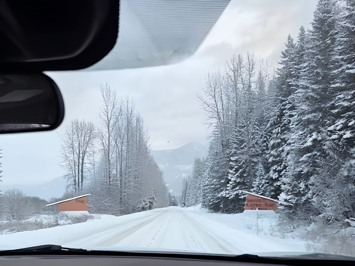
MT-56 is a state-maintained highway, so it gets regular winter attention, but conditions in this valley change fast and the road is shaded for long stretches. Check MDT 511 before and during the drive, give yourself daylight, and come with proper tires. If you are heading up to Turner Mountain during your stay, the same advice applies to that road.
The quietest season on these roads. Runoff is high, forest roads may still be soft or closed, and some trailheads are not reachable even when the highway is clear.
The last stretch of Highway 56 does something to people. The traffic falls away, the forest closes in, and by the time you reach the lake the drive has already started doing the work you came here for. It is a long way in on purpose.
Once you have arrived and unpacked, the area around the cabin opens up quickly – Ross Creek Cedars is 6.1 miles and thirteen minutes back up the road you came in on, and the Cabinet Mountains start almost at the door. For a sense of the cabin itself before you come, have a look at the stay.
Shangrilog sleeps up to 10 on Bull Lake in Northwest Montana. When you're ready to plan a visit, we'd love to host you.
Glacier Park International (FCA) in Kalispell is the closest, at 134 miles and about 2 hours 24 minutes from the cabin. Spokane International (GEG) is 142 miles and about 2 hours 38 minutes by the southern route through Sandpoint, and usually offers the widest choice of flights. Missoula Montana Airport (MSO) is 156 miles and about 2 hours 51 minutes. All three require a rental car for the drive in.
Yes. There is no public transit to Bull Lake and no airport shuttle service to the cabin. Plan on renting a car at whichever airport you fly into.
Cell service is spotty on the final approach to the lake. Download offline maps for the area before you leave Libby or Sandpoint, and do not rely on being able to look up directions once you are on Highway 56.
Fuel up in Libby, Sandpoint, or Trout Creek before you turn onto Highway 56. There is no reliable fuel along the lake itself.
Yes. Montana Highway 56 is a state-maintained highway and stays open through the winter, but conditions change quickly in this valley. Check MDT 511 before you travel, allow extra time, and drive it in daylight if you can.
Troy is the nearest town, 24.6 miles and about 31 minutes north of the cabin. Libby has the fuller range of services, 36.7 miles and about 42 minutes via Highway 56 north and US-2 east. Do a full grocery run in Libby or Sandpoint on the way in.